This post contains affiliate links. If you click and purchase, we may earn a small referral fee at no extra cost to you. Read our full disclosure.
Lake Erie’s 6,261,500 acres border four states – New York, Pennsylvania, Ohio and Michigan – and the province of Ontario, Canada. Contained within this Great Lake are about 36 islands, some large and developed and others small and uninhabited.
Read on as we highlight four of the islands in the Bass Island Archipelago in northwest Ohio near Sandusky: South Bass Island, Middle Bass Island, North Bass Island, and Kelleys Island. With the exception of North Bass Island, these picturesque, glacier-sculpted islands provide easily-accessible vacation destinations.
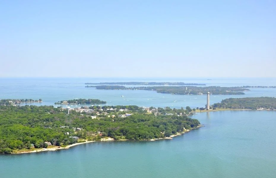
South Bass Island
South Bass Island is a tourist-friendly destination accessible by ferry, just three miles from the tip of Catawba peninsula on the mainland. Summer vacationers dramatically increase the small population of year-round residents.
The village of Put-in-Bay, nicknamed the “Key West of the North,” is a Victorian-style town that has offered refuge to sailors and fishermen for hundreds of years. Today, the village’s festive atmosphere serves up a healthy portion of boutiques, restaurants, and lively musical entertainment.
For vacationers who prefer more solitude, South Bass Island State Park offers wooded camping and lakeside picnicking perched atop scenic white limestone bluffs.
Perry’s Victory & International Peace Memorial is an island landmark that commemorates the Battle of Lake Erie during the War of 1812, and celebrates the long-lasting peace among the USA, Canada and the UK.
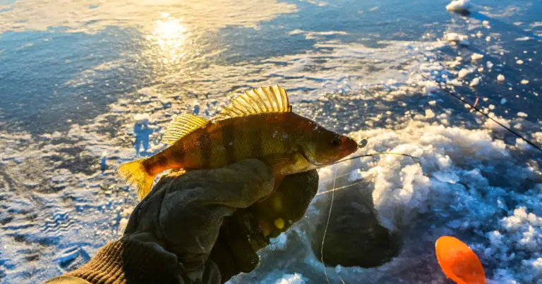
South Bass Island offers some of the best smallmouth bass fishing in the world, too.

Middle Bass Island
Middle Bass Island is also a well-developed island accessible by ferry boat. Shaped like the Big Dipper, French explorer Robert La Salle named the island ‘Isle des Fleures,’ the Floral Island, in 1679 because of the abundance of wildflowers.
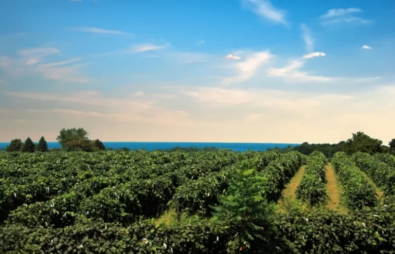
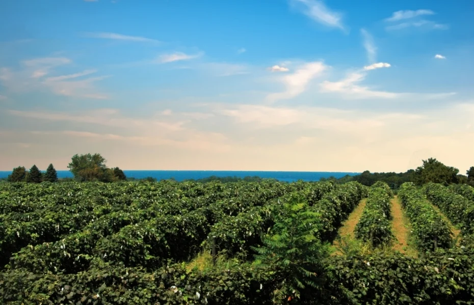
The island retained this name for 200 years until a German count acquired the island in 1856 and began growing grapes. The Golden Eagle Winery, later the Lonz Winery, produced German Rhineland-type wines until the 1970s.
In 2001, the State of Ohio purchased part of the Lonz Winery and its marina complex to create Middle Bass Island State Park. Today the Park offers camping, cabins, resort lodges and a marina with boat slips. Cycling, kayaking and paddleboarding are all popular pursuits.
Middle Bass is a low, green island speckled with glacial grooves and beaches. The Middle Bass Kuehnle Wildlife Refuge is on one of North America’s main bird and monarch butterfly migratory paths. The best time to view the monarch’s route between Canada and Mexico is late August and September. Bird watching is best during the spring and fall migrations.
North Bass Island
North Bass Island, also known as Isle Saint George, has not been commercially developed. Access is by private boat or plane.
The State of Ohio owns 86 percent of the land, preserved as North Bass Island State Park. The Park is open for low-impact recreational opportunities only – camping, fishing, hiking, swimming, picnicking, biking and wildlife viewing.
Public roads connect landmarks such as the island’s chapel, cemetery, and historic houses. The State leases 38 acres to Ohio’s Firelands Winery “to preserve North Bass Island’s cultural fabric and history of vineyards and winemaking.”
A small population of permanent residents owns the remaining private property. Vacationers looking for a secluded island experience will make the extra effort to visit North Bass Island.
Sip and Savor Along Lake Erie’s Grape Belt and Wine Trail
New York’s Finger Lakes are well-known tourist destinations, and their wines have gained international recognition. But how many Lakelubbers have heard of New York’s Concord Grape Belt and the Chautauqua-Lake Erie Wine…
Kelleys Island
Kelleys Island, located east of the three Bass Islands, is accessible by public ferry. Kelleys is well-developed as a vacation destination with beaches, parks, campgrounds, resorts, shopping, and restaurants.
The entire island is on the National Register of Historic Places. The island was renamed in 1840 for the Kelley brothers who cultivated the island’s quarrying, logging, and winemaking. Limestone quarrying continues today.
The Glacial Grooves, a National Natural Landmark, are the largest easily accessible limestone grooves in the world – a trough 400 feet long, 35 feet wide, and 10 feet deep. Inscription Rock State Memorial is a flat-topped limestone slab marked with prehistoric Indian carvings of animals and human figures dating back to AD 1200 to 1600.
Kelleys Island State Park offers camping, a boat launch ramp, swimming, picnicking, hiking trails, fishing, birdwatching and winter recreation (ice skiing, cross-country skiing, ice fishing). The Alvar State Nature Preserve is located within the park; alvar is a Swedish word describing barren limestone or dolomite exposed by receding glaciers.
Ferries to the Lake Erie Islands depart from Port Clinton, Marblehead, and Sandusky. Ferries generally run May to October. To view a map of the Lake Erie Islands, click here .
Great Lakes Circle Tour: North America’s Fresh Coast
The Great Lakes thrill us with their beauty and inspire us with their magnitude. In 1988, the Great Lakes Commission approved a Great Lakes Circle Tour to create a scenic, international road system connecting…